Research Areas
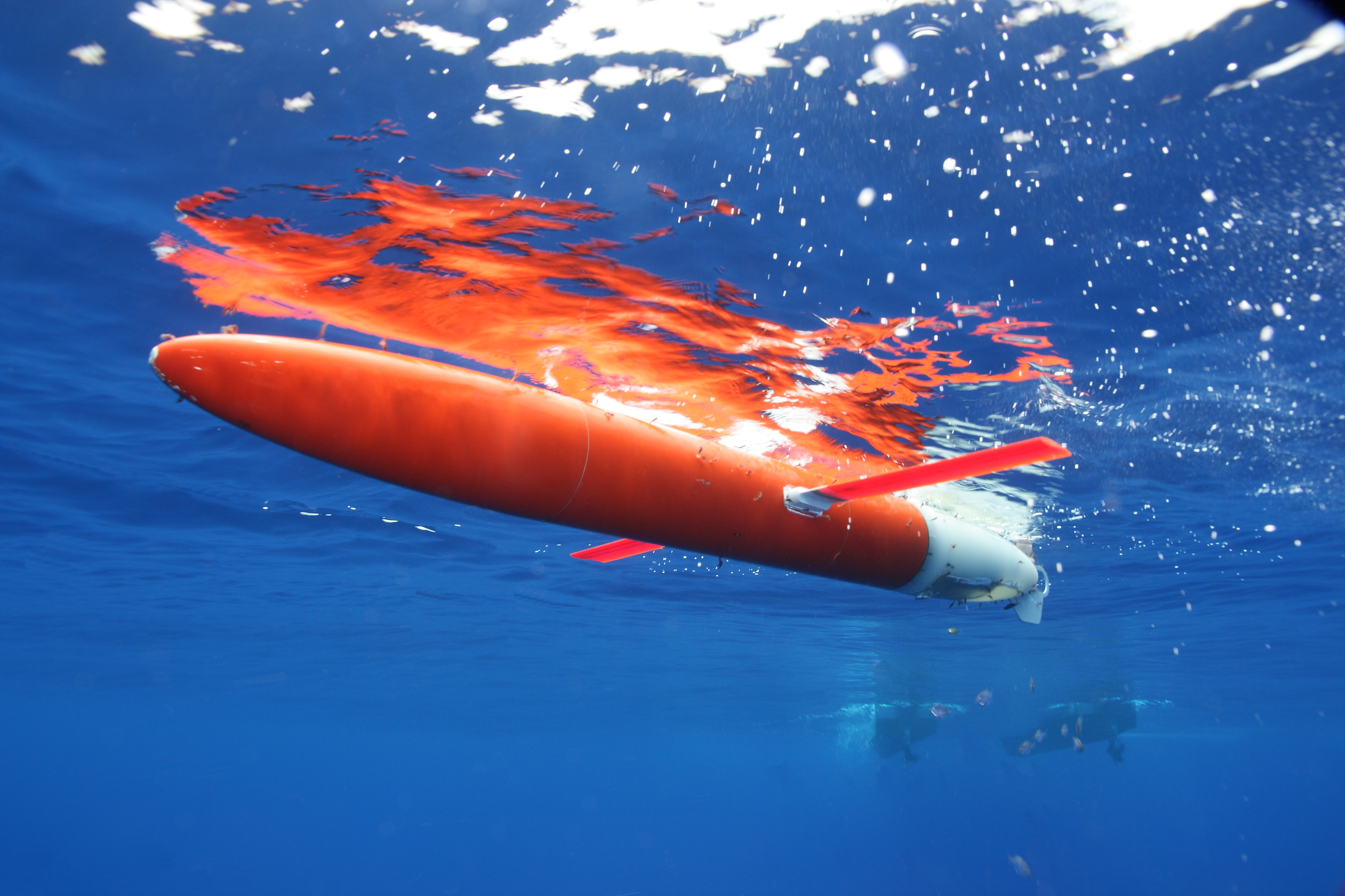
Research in our group focuses on boundary, coastal, and equatorial current systems. We primarily use autonomous underwater gliders (http://gliders.whoi.edu) to collect long-duration, high-resolution observations that are then analyzed to understand upper ocean dynamics in these regions. The Spray glider, pictured at right, was designed at Scripps and WHOI and is our primary observing platform.
We work in a variety of locations around the world. On this page, you will find brief overviews of results from some of those areas. Full details are available in our group's publications.
Research in our group has been generously supported by the Office of Naval Research (ONR), National Science Foundation (NSF), National Oceanic and Atmospheric Administration (NOAA), Eastman Chemical Co., and WHOI.
Gulf Stream
The Gulf Stream carries warm waters from the tropics to higher latitudes as it flows along the US East Coast, is a major source of the kinetic energy that stirs the ocean across a range of scales, and exhibits substantial variability in strength and position along the US East Coast at timescales from several weeks to years. While the significance of the Gulf Stream to the global climate system has long been recognized, subsurface observations that resolve its variability and dynamics are limited. Our group is using Spray gliders to fill the observational 1500-km-long gap between established, long-term sampling in the Florida Strait (NOAA’s Western Boundary Time Series) and downstream of Cape Hatteras (e.g., the Oleander program).
Our current Gulf Stream sampling plan sees one glider deployed just offshore of Miami, FL every two months. Each glider is commanded to steer perpendicular to measured currents when in the Gulf Stream. The resulting glider trajectories cross the Gulf Stream obliquely because the gliders are carried downstream while crossing the Gulf Stream. During missions lasting about four months each, gliders complete about 10 Gulf Stream crossing each while moving downstream from Florida to New England. To date, more than 225 cross-Gulf Stream transects have been collected by our gliders.
Analysis of the observations from this ongoing program have yielded a number of new findings about the Gulf Stream. Among those are:
Potential Vorticity Structure and Stability: Potential vorticity is an important dynamical quantity in western boundary currents and can be used to diagnose the susceptibility of the current to various instabilities. Since gliders provide high-resolution measurements of both hydrography and velocity, we are able to estimate the full Ertel potential vorticity from the observations. Todd et al. (2016, J. Phys. Oceanogr.) combined early Gulf Stream glider measurements with similar measurements in the Loop Current to characterize potential vorticity structure in two segments of the North Atlantic western boundary current and to evaluate classic criteria for barotropic, baroclinic, centrifugal, and symmetric instabilities.
Along-Stream Evolution: Heiderich & Todd (2020, J. Phys. Oceanogr.) characterized the evolution of Gulf Stream volume transport as it flows along the US East Coast. Combining velocity and hydrographic measurements, they showed that the increase in volume transport is mainly due to entrainement of subsurface waters from the offshore side of the Gulf Stream.
Mean and Eddy Kinetic Energy: Using glider-based velocity measurements, Todd (2021, Geophys Res. Lett.) produced the first fully three-dimensional estimates of mean and eddy kinetic energy for the Gulf Stream region.
Topographic Effects: Over the relatively shallow Blake Plateau, strong flow associated with the Gulf Stream reaches to the seafloor. Todd (2017, Geophys. Res. Lett.) identified two mechanisms by which energy is extracted from the Gulf Stream as it flows over this shallow topography. Large-amplitude internal lee waves with frequencies near the local buoyancy frequency are generated near the Charleston Bump, a prominent topographic feature, and their vertical motion can be inferred from perturbations in the flight of gliders. In the same region, O(100)-m-thick bottom mixed layers are generated in the lee of topography, likely due to enhanced turbulence generated by O(1) m s-1 near-bottom flows.
Impact on Numerical Simulations: Temperature and salinity observations from Spray gliders operating in the Gulf Stream are routinely distributed in near-real time for operational usage and are made publicly available and citable after post-processing (Todd and Owens, 2016; doi:10.21238/S8SPRAY2675). Using the US Naval Oceanographic Office’s operational NCOM US East simulation as an example, Todd and Locke-Wynn (2017, Oceanography) showed how high-resolution, subsurface measurements of the strong, narrow front associated with the Gulf Stream can improve the model’s representation of the Gulf Stream’s structure. Similar impacts in other operational and reanalysis simulations that assimilate the observations are expected.
Submesoscale Coherent Vortices: Gula et al. (2019, Geophys. Res. Lett.) document the existence of subsurface submesoscale coherent vortices (SCVs) within the Gulf Stream using glider and seismic observations. Numerical simulations were then used to show that SCVs likely form in the vicinity of the Charleston Bump by frictional effects and intense mixing (Todd et al., 2017, Geophys. Res. Lett.) as the Gulf Stream encounters topography. The SCVs are then advected away from the continental margin, carrying waters with them into the ocean interior.
Cape Hatteras
Offshore of Cape Hatteras, NC, coastal waters from the Middle Atlantic Bight and South Atlantic Bight converge in close proximity to the Gulf Stream as it separates from the continental margin. The NSF-funded ‘Processes driving Exchange At Cape Hatteras (PEACH)’ program aims to understand the dynamics controlling exchange between the continental shelf and deep ocean in this highly variable area. Observations from a variety of observation platforms, including Spray gliders operated by our group, are being combined with numerical models to understand the drivers of exchange.
Using two years of continuous glider observations, Todd (2020, J. Geophys. Res.) examined the export of relatively fresh waters from the Middle Atlantic Bight shelf to the deep ocean. The export is dominated by sporadic events, rather than steady flow. The characteristics of these evnets vary widely; some are associated with passing storms. In the winter of 2017-2018, Gulf Stream waters along the upper contiental slope resulted in near-complete cessation of this shelf water export between Cape Hatteras and the NC/VA border. Han et al. (2021, J. Phys. Oceanogr.) combined various PEACH observations to characterize the one observed export event during this period.
Indian Ocean
Circulation in the equatorial and tropical Indian ocean is strongly influenced by the Asian monsoon, which has large-scale winds switching directions twice per year. As part of two ONR-funded DRIs, ‘Northern Arabian Sea Circulation–autonomous research (NASCar)’ and ‘Oceanic Control of Monsoon Intra-seasonal Oscillations in the Tropical Indian Ocean and the Bay of Bengal (MISO-BOB)’, we have conducted Spray glider surveys in the western equatorial Indian Ocean and the Bay of Bengal. Todd (2020, Geophys. Res. Lett.) used these observations to examine how the equatorial currents respond to the onset of the boreal summer monsoon. Shroyer et al. (2021, Bull. Amer. Meteorol. Soc.) used a variety of observations from MISO-BOB to characterize the onset of the 2018 summer monsoon in the Bay of Bengal.
Middle Atlantic Bight
The continental shelf circulation over the Middle Atlantic Bight is strongly influenced by both offshore forcing (e.g., Gulf Stream rings) and passing weather systems (e.g., Nor’easters and Tropical Storms/Hurricanes). As part of a NOAA-funded program entitled `The Experiment to Measure and Predict East coast STorm Strength (TEMPESTS)’, we deployed a Slocum glider over the Middle Atlantic Bight shelf ahead of Hurricane Arthur (2014) and Hurricane Hermine (2016), as well as during springtime storms. The hurricane related work is documented in Goni et al. (2017, Oceanography). The Middle Atlantic Bight shelf break is also home to the Ocean Observatories Initiative’s Pioneer Array, which consists of moorings and gliders deployed for several years to measure shelf-ocean exchange processes. Prior to construction of the Pioneer Array, a Spray glider surveyed the region, and our analysis of those glider observations identified the key horizontal scales that the Pioneer Array needed to resolve (Todd et al., 2013, J. Phys. Oceanogr.). More recently, we have begun analysis of the large volume of observations collected by Pioneer Array Slocum gliders; initial results from that examination suggest that shelfbreak processes and regional water properties have been heavily influenced by Gulf Stream Warm Core Rings in recent years (Gawarkiewicz et al., 2018, Oceanography).
California Current System
Along the West Coast of the US, the California Current System consists of a cool, fresh, equatorward flow near the surface (the California Current) and a warmer, saltier, poleward flow along the continental margin (the California Undercurrent). For more than a decade, Spray gliders have routinely surveyed along three cross-shore lines off central and southern California. Todd’s Ph.D. thesis work at the Scripps Institution of Oceanography relied on these observations. More on the results from the California Underwater Glider Network are available from the CUGN page at Scripps.
Eastern Equatorial Pacific
The Galápagos Archipelago is situated on the equator in the eastern Pacific, so it presents a barrier to the eastward flow of the Pacific Equatorial Undercurrent. The NSF-funded ‘Repeat Observations by Gliders in the Equatorial Region (ROGER)’ program used Spray gliders from our group at WHOI and from our collaborators at Scripps to survey the Equatorial Undercurrent and Equatorial Front to the west of the Galápagos for multiple years. Jakoboski et al. (2020, J. Phys. Oceanogr.) analyzed how the Pacific Equatorial Undercurrent bifurcates as it encounters the Galápagos and estimated the upwelling rate in the region just west of the islands. Rudnick et al. (2021, J. Phys. Oceanogr.) examined the oceanic signal associated with the 2015-2016 El Niño in the region. Karnauskas et al. (2020, J. Geophys. Res.) evaluated the representation of the Pacific equatorial undercurrent in global climate models.
Doppler Current Profilers on Autonomous Underwater Gliders
With colleagues in the Instrument Development Group at Scripps, we have led efforts to use small acoustic Doppler current profilers (ADCPs) to estimate absolute horizontal velocities from gliders. Unlike geostrophic current estimates that are routinely made using glider observations of temperature, salinity, and depth averaged currents, ADCP-derived current estimates are available for each glider dive and in both horizontal directions. In equatorial regions, ADCPs on gliders allow us to measure the vertical structure of currents where the geostrophic estimates cannot be used due to the vanishing of the Coriolis parameter. We have also shown that ADCP measurements can be used to correct for the effects of biofouling-induced drag on glider-based estimates of depth averaged currents. Results from this work have been published in Todd et al. (2011, J. Geophys. Res.; 2017, J. Atmos. Oceanic Technol.).